The Shuswap Loop
Hiking Area
Blind Bay

McArthur Heights Trail Claim this business

4.8(26 reviews)
Open · Closes 10:00 PM

Quick answers about McArthur Heights Trail

Listed under Hiking Area. Serving Blind Bay. Services include Hiking Area and Summit Viewpoint.

About

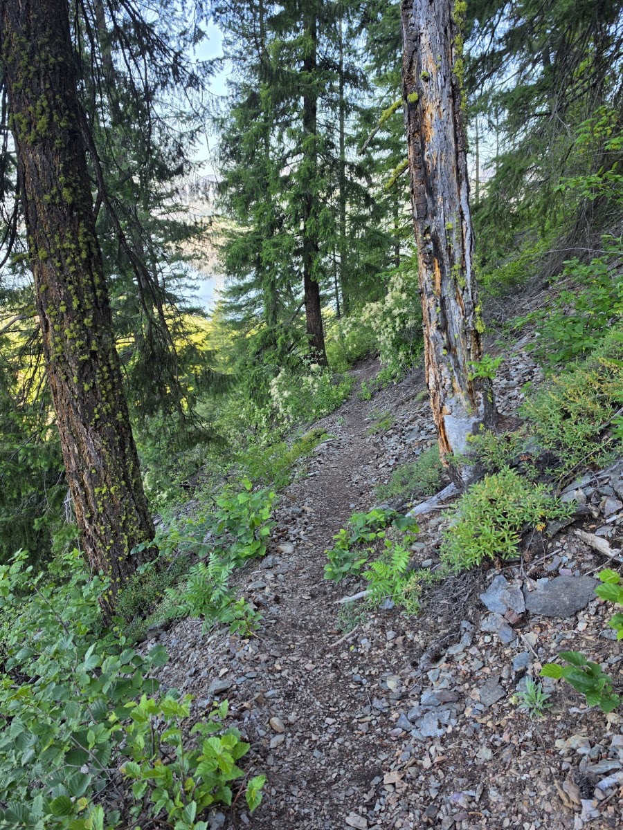
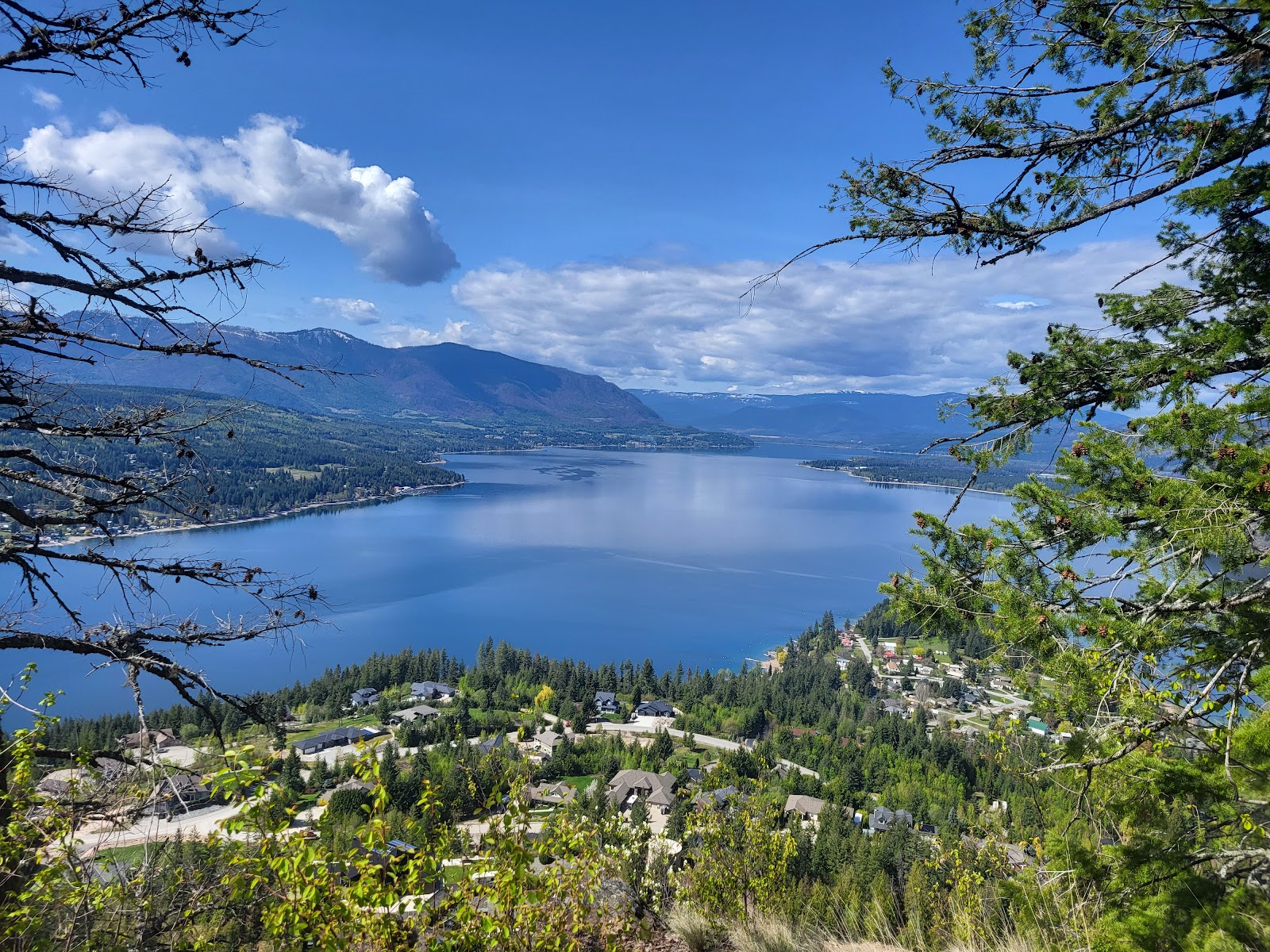
McArthur Heights is a short but seriously steep climb above Blind Bay. In just 1.7 km the trail zig-zags up switchbacks, scree and exposed rock to a summit with sweeping views of Blind Bay, the South Shuswap, Squilax and Chase, with Todd Mountain at Sun Peaks on the horizon. Plan on roughly an hour up.

Trail at a glance

  • Distance: 1.7 km one way from the McArthur Heights trailhead
  • Difficulty: Most difficult
  • Trailhead: turn north onto Balmoral Road, right on Reedman Point Road, left on McBride Road, then follow it to the end of the road and park
  • Longer option: continue about 8 km south along the ridge to the Balmoral Lookout and arrange a shuttle at the Balmoral trailhead

Good to know

The trail is narrow and exposed, with loose rock and steep drop-offs — keep children well back, and don't cut switchbacks on the erosion-prone slope. Poles help on the descent. The trail is maintained by the Shuswap Trail Alliance.

McArthur Heights is a public trail rather than a business, so there's no owner to claim this page; trail volunteers can reach The Shuswap Loop to share closures or updates.

Services

Hiking AreaSummit Viewpoint

Send an Inquiry

Contact McArthur Heights Trail directly for quotes or questions.

Frequently Asked Questions

Is this your business?

Take control of your business page, respond to inquiries, and attract more local customers.

Claim this profile

Contact Info

  • AddressMcBride Rd, Blind Bay, BC V0E 1H1, Canada
  • Also serves
    Blind Bay
  • Located inBlind Bay
  • Hours
    Monday7:00 AM – 10:00 PM
    Tuesday7:00 AM – 10:00 PM
    Wednesday7:00 AM – 10:00 PM
    Thursday7:00 AM – 10:00 PM
    Friday7:00 AM – 10:00 PM
    Saturday7:00 AM – 10:00 PM
    Sunday7:00 AM – 10:00 PM

Explore more in Blind Bay

Local guide →

Your ad here

Contact us to advertise in this spot

Photosfrom Google

6 photos

Reviews

4.8(26 reviews)
Terri Cummings
Terri Cummingson Google
a year ago

Conditions are excellent right now. I only went up 1k and came back down the same way. It’s steep with lots of switch backs but worth the view , I stopped at the first posted lookout. Take one and paper and you can drop a note in the tin that is stashed up there. I’d recommend a walking stick for this one and water!

Talk Nice To Me
Talk Nice To Meon Google
7 years ago

Worthy payoff with the view and a hell of a workout to get up. To get down you can go back the steep crazy way you ascended or do a longer more knee-friendly hike down the back of the mountain. We did the latter and round trip it took us less than 3 hours ... but we did stop for pictures and such. If you take the longer way down, just stick to the right.

coucai
coucaion Google
a year ago

Moderate trail with a beautiful lookout!

Vivian Morris
Vivian Morrison Google
a year ago

The most scenic hike in the Shuswap.

Joseph Jores
Joseph Joreson Google
a year ago

Spectacular views, steep climb, a workout.